Friday, October 25, 2013

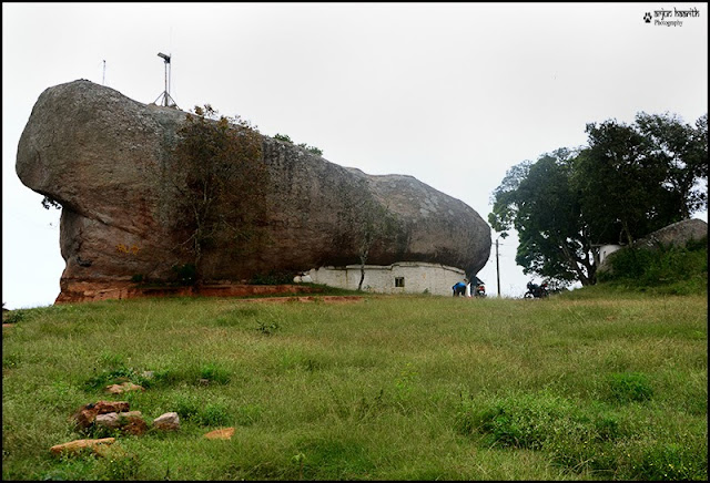
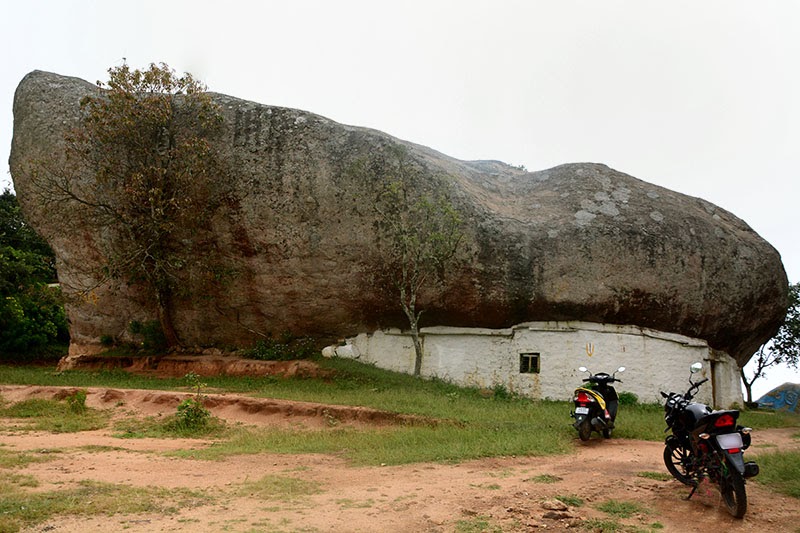
Bilikal Rangaswamy Betta

(best viewed in Google Chrome or Mozilla Firefox)

" A weekend Getaway - Bilikal Rangaswamy Betta  "

I did the GHNP trek way back in August. After a very long gap of two months, my legs began to itch. Well, its not because of leeches. But, its for longing to go for a trek. 

So after a lot of permutations and combinations, I selected few places and finalized on one place.

We were supposed to trek "Bandalli Durga"  and had planned everything accordingly. But the previous day, I read somewhere, that we need permissions to trek to this place. Well I am not sure how true is this.

And at the last moment, getting permissions and arranging a transport became difficult. Hence the plan to trek Bandalli Durga got cancelled. 
Eventually 2 of my trekking friends (Sri Vatsa and Bhargav) Gave Hands at the last moment :)

So only three of us (Karthik , Thammaiah and Myself) decided to continue with the trekking plan. We were ready with all the required items, but the place was not decided yet. Many ideas came to mind, but got cancelled due to many reasons.

Later on, my friend Ramnath Kamath suggested me this place. Thanks Buddy !!!

The plan (Saturday , 19-10-2013) :
11.00 AM : Depart from Bangalore
2.00 PM : Reach the place and Start trek
4.00 PM : Trek to the summit
5.00 PM : Relax and pitch the tent

But due to sudden/unexpected work , I had to stay till 1.30 PM in the office. We left Bangalore by 2.00 PM

We went in our own bikes. Tammy bought his Deo and I took my bike (Twister). On the way, Karthik joined us.
Finally after all the hassles, we were out of Bangalore City Limits by 2.45 PM. Now this became too late than we thought.

On the way, we had lunch at a Dhaba in Kanakpura road. Though the food was not good, our hunger made it tasty.

Reached Harohalli, and took the left that goes to Maralwadi. After going around 3-4 kms, locals there suggested us to take a different route since that road was bad.

So we again came back to Harohalli and planned to take the route which they suggested. "But this route was also not good" told another villager.
Well, this was becoming like a film climax :)

One guy suggested that we go to Kanakpura and then go forward. So, we headed towards Kanakpura. By now, it was 5 PM. 
We could see a thick black cloud following us. We were sure that we were going to drench in the rain before going to BR betta.

Any villager whom we asked for the route, advised us not to go there since the place is infested with lots of elephants. 
Not even a single guy gave a positive answer :)
Since it was getting dark, we discarded the plan of trekking and thought of going to the hill top in the bike itself. 
Till the base of the hill, the roads are very good. From there on, the fun of riding starts.

The fun of riding : This was all together a different experience for all of us, since we had never ever rode a bike in such a terrain. Its completely a tailor made terrain for a Gypsy 4x4 , Bolero or a Bullet.

Once we started climbing up, felt pity on the bikes. We could also see fresh elephant dung on the way which was a thrilling experience.

Somehow, reached the top of the hill by 6.30 PM. It was almost dark and could see lightning flashing and hear the sound of thunder.

Pitched the tent and we went in. Alas, after 5 mins it rained so heavily that we could not hear anything except the rain and thunder. Went inside the tent just in time. Indeed Lucky !!!

It Rained heavily till morning. 

Meanwhile Tammy and Karthik had brought eatables which were enough for 2 days :), but due to all the hardships we faced, the food was over within next day.

The night was thrilling, since it was raining continuously and the winds were blowing the tent. But the tent was strong enough :)

Apart from that many unusual sounds made us to stay awake for a long time, especially Karthik :) 

The next morning :

We collected few fire woods and started making the camp fire. Tammy was the one who took a lot of trouble and finally succeeded in making the camp fire. Karthik also helped him in this.


Finally the camp fire was ready, and we made Maggi and Coffee which was " Out of the World. "


Tammy and Karthik


Temple and the tent - Valley covered with mist


The temple covered in Mist

Trekking towards the peak

A small house at the hill top

Kalyani

Guys enjoying the view


The previous mid night, another group of trekkers from Bangalore had come to the top. 


Srikanth and Group


The only Elephant that we saw :)
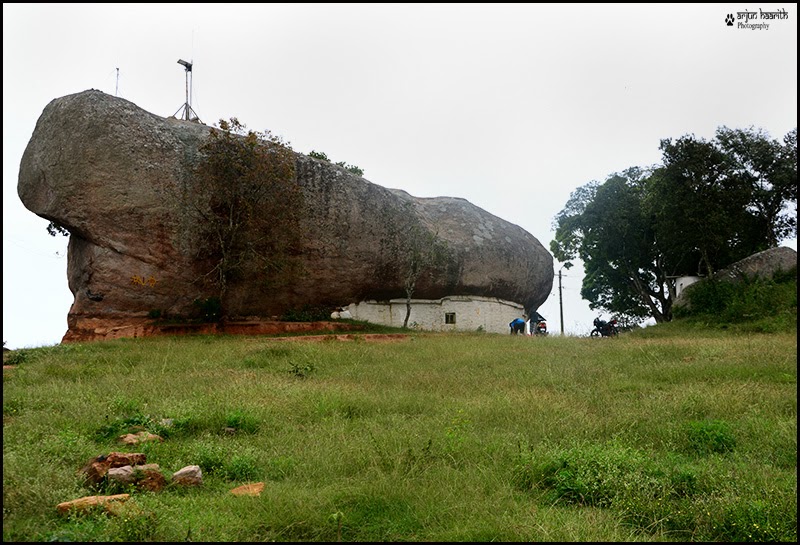


 The Peak as seen from a far distance


We collected most of the plastic papers and bottles that were thrown around at the top, by some of the "Uncivilized Trekkers and Uncultured People" and brought them back down and disposed it.


How to Go :

1. Go Towards Kanakapura via Banashankari , Harohalli .
2. Once you reach Kanakapura, Take left towards Arkavathi bridge and go forward
3. Ask locals (Best and safe way)

Tips :

1. Take some eatables and water with you since nothing is available there
2. If you are planning to camp there, make sure you take a good tent or a Sleeping bag.
3. It is very risky to take Deo or Similar vehicles, since the road is very bad.
4. Please do not take any alcohol or things like that. Remember its a temple premises.
5. Do not leave any plastics,bottles and anything there. Bring it along with you back down and dispose it.
6. It is you the one, who has to protect nature.


Monday, September 16, 2013

From Here to Eternity - An exploration of the universe through the Lens

(Best viewed in Google Chrome or Mozilla Firefox)

We had been to Great Himalayan National park which is situated in the Kullu valley of Himachal Pradesh during August 2013. Though it was a prime monsoon season, the rains were not that dominant in the hill state during the time we stayed there.

The rain and the sun were always playing the game of Hide and Seek which gave me the feeling of the unpredictable Himalayan climate.

The team consisted of (Mr. Bhaskar , Mr. Presley , Bharath , Chiru and Myself). 

 I always wanted to see the night sky in its full glory in the Himalayas, as the night sky in the city seems to be disturbed due to light pollution.

Watching the night sky was an amazing experience, as we were busy in arguing about the planets like Jupiter or Venus and even Mars too. Also connecting the stars and visualizing the constellation was equally thrilling. 
There were few meteoroids or shooting stars that passed by and the joy of seeing them booming is to be experienced.

Our experiences and adventures in the hills of GHNP will be followed by another blog. This blog is mainly about Star (Night Sky) Photography.


Here are few images that I shot during my stay in the valley.

All these images are my first attempt, and hoping to improve them in my future encounters with the night sky. Most of them are just record shots which represents the actual sight of amazement and excitement that I faced when we saw the beautiful gems hanging in the sky in the laps of the mighty Himalayas.

(Milky way shot at the Rangthar meadows in the National Park)


Star trails photography is one my favorite theme in the vast world of Photography. 

A star trail is a type of photograph that utilizes long-exposure times to capture the apparent motion of stars in the night sky due to the rotation of the Earth. A star trail photograph shows individual stars as streaks across the image, with longer exposures resulting in longer streaks. Typical exposure times for a star trail range from 15 minutes to several hours, requiring a 'bulb' setting on the camera to open the shutter for a longer period than is normal.

(Milky way and our tent)

Star trail photographs are possible because of the rotation of the Earth on its axis. The apparent motion of the stars is recorded as streaks on the film or detector. For observers in the northern hemisphere, aiming the camera towards the north creates an image with concentric circular streaks centered around the north celestial pole.

Star trail photographs can be used by astronomers to determine the quality of a location for telescope observations. Star trail observations of Polaris have been used to measure the quality of seeing in the atmosphere, and the vibrations in telescope mounting systems

Star trails have been used by professional astronomers to measure the quality of observing locations for major telescopes.


Star trails formed in the backdrop of our tent with the North star towards the left


The Milky Way is the galaxy that contains our Solar System. Its name "milky" is derived from its appearance as a dim glowing band arching across the night sky in which the naked eye cannot distinguish individual stars. The term "Milky Way" is a translation of the Classical Latin via lactea, from the Greek γαλαξίας κύκλος (pr. galaxías kýklos, "milky circle").


Milky way and the camp fire


From the Earth, the Milky Way appears like a band because its disk-shaped structure is viewed from within the Galaxy. Galileo Galilei first resolved the band of light into individual stars with his telescope in 1610. In the past, astronomers thought that all of the stars in the universe were contained inside of the Milky Way.


The Milky Way is a barred spiral galaxy some 100,000–120,000 light-years in diameter which contains approximately 100–400 billion stars. It may contain at least as many planets as well. The Solar System is located within the disk, about 27,000 light-years away from the Galactic Center, on the inner edge of a spiral-shaped concentration of gas and dust called the Orion–Cygnus Arm. 


The stars in the inner ≈10,000 light-years form a bulge and one or more bars that radiate from the bulge. The very center is marked by an intense radio source named Sagittarius A* which is likely to be a supermassive black hole.


Stars and gases at a wide range of distances from the Galactic center orbit at approximately 220 kilometers per second. The constant rotation speed contradicts the laws of Keplerian dynamics and suggests that much of the mass of the Milky Way does not emit or absorb electromagnetic radiation. 


The stellar disk of the Milky Way Galaxy is approximately 100,000 ly (30 kpc) in diameter, and is, on average, about 1,000 ly (0.3 kpc) thick As a guide to the relative physical scale of the Milky Way, if it were reduced to 100 m (110 yd) in diameter, the Solar System, including the hypothesized Oort cloud, would be no more than 1 mm (0.04 in) in width, about the size of a grain of sand.
(Source : Wikipedia)

The Milky Way and the Andromeda Galaxy are a binary system of giant spiral galaxies belonging to a group of 50 closely bound galaxies known as the Local Group, itself being part of the Virgo Supercluster.


How to Photograph Star Trails ?

Firstly lets see the things you need before shooting star trails
(Going to Remote areas or forests like Himalayas or Western ghats, which is very far from the city gives a chance to get a good and clear sky)

Things needed :

1. A Digital SLR Camera (or a camera with the ability to shoot under Manual mode with Bulb Setting)
2. A Good Tripod
3. A wired shutter release with a mechanism to lock the shutter button down
4. A clear, dry night
5. Spare batteries
6. Time and Patience
7. Something to clean the lens if it becomes foggy
8. Powerful Torch
9. Off course a Clear sky with bright stars :)

Setting up the equipment : (Based on my experience)


1. Set up the camera by mounting it firmly on a tripod and compose the image accordingly.

2. Change the priority to "M" , meaning Manual and select Bulb mode.

3. Set the focus to infinity (Manual Focus), never use the auto focus since it searches(hunts) once the remote is clicked. 

4. Set the Long Exposure Noise reduction as High (On) in the camera - this reduces the noise in the image. If it is Off also, it is not a problem

5. Focus on any distant bright object and leave the focus ring unchanged.

6a. For shooting star trails :
 
Set the aperture to F/3.5 - F/5.6 , with ISO 400 to 800 , for less noise.

Usually you can keep the shutter open from 15 mins to 1 hour or even more depending on the situation.
So what many people do is shoot images with an interval of 1 min and stack the images using the software.

6b. For Shooting the Milky way without the formation of trails :

The same setting(Steps 1 - 5) has to be followed. 
Later, set the biggest aperture (Smallest F number like F/2.8 or F/3.5 etc ), and increase the ISO to 3200 and above if required.

I followed this rule to calculate time :
( T = 500 / F) , 
where T - time , F - Focal length 

Suppose you are using an 18 mm lens, the time can be set as 500/18 = 27.77 secs which is ~ 30 secs
Hence I gave the exposure time of 30 secs. Giving more time may lead to formation of streaks(trails) in the images.

Click the image under different setting of ISO's and compare the results as You are the best judge.

7. If you keep the shutter open for 20 mins and have your camera setting as Long exposure NR as On , then your camera won't be usable for another 20 mins after you have shot the image since it will be processing the image.

8. Always a wide angle lens such as Tokina 11-16 mm / Nikon 12-24 mm / Nikon 18-105mm (As I am a Nikon user) etc is suitable for star trails.

9. And the main thing , enjoy the moment with your eyes too :)

The Equipment I used : 

Nikon  D90 
Nikon 18-105mm F/3.5 - F/5.6 VR lens
Benro Tripod
Aputure timer remote (Intervellometer)


Thank You


Monday, June 3, 2013

Pokhara - Mountaineers Delight

(Suggested Browsers : Google Chrome or Mozilla Firefox)

Pokhara  is the second largest city of Nepal and is situated about 200 km west of the capital Kathmandu. It serves as the headquarters of Kaski District, Gandaki Zone and the Western Development Region.
Pokhara is one of the most popular tourist destinations in Nepal. Three out of the ten highest mountains in the world — Dhaulagiri, Annapurna I and Manaslu — are situated within 30 miles (linear distance) of the city, so that the northern skyline of the city offers a very close view of the Himalayas. Due to its proximity to the Annapurna mountain range, the city is also a base for trekkers undertaking the Annapurna Circuit through the ACAP region of the Annapurna ranges in the Himalayas.

There was a huge Maoist problem in Kathmandu(and whole of Nepal) , all the Shops were closed, transportation had come to a halt. We never thought the situation would be so bad. The hotel and sightseeing trip was booked at Pokhara beforehand. However, we managed to get few seats in a local bus that plies from Kathmandu to Pokhara.  

The route from Kathmandu to Pokhara is very scenic, which offers the view of some great valleys , rivers , lush green forests and a bypass route to the famous Manakamna temple. There are many places  where adventure sports like Kayaking and white river rafting along the Trishuli river are conducted enroute.


After a light breakfast on the way, we headed towards Pokhara. But on the way, some protesters got into the bus, and caused a delay of around 30 mins to our journey.

We reached Pokhara at noon, checked into a nice hotel "Nepal Guest House" , which is on the banks of the Phewa Lake.


Places of interest :

1. Phewa Lake : Phewa Lake, Phewa Tal or Fewa Lake is a freshwater lake in Nepal located in the south of the Pokhara Valley that includes Pokhara city; parts of Sarangkot and Kaskikot. The lake is stream-fed but a dam regulates the water reserve, therefore, the lake is classified as semi-natural freshwater lake. It is the second largest lake in Nepal, the largest in Gandaki Zone.


The Boat ride is a fun filled moment for everyone.
We can get the first glimpse of Mt. Macchapucchare from here. 


There is a small island in the middle of the lake called as the Barahi island. This has a temple named Barahi Mandir or the Tal Barahi mandir.

One of the most popular landmarks in Pokhara is the Barahi temple, which is visited by hundreds of people everyday. The temple is situated on an island surrounded by Phewa lake.

People visiting Pokhara are most certain to make a trip to the temple. The only way to go there is by boat.


After a beautiful and refreshing boat ride in the lake and a divine visit to the temple, the stress of the bus journey had vanished. We were also energized to do some more adventures :)

By this time, the sun began to set, and I was waiting to do some sunset photography.

Two major ways of transport apart from bus are Boat and Bicycle. One can get a bicycle for a day's/week's rent depending on the availability.


Enjoying Sunset in the lap of Himalayas is something special.

The next morning, we had planned to go to Sarangkot, to enjoy the beautiful sunrise with the majestic mountains in the background. But, we did not get any transport as the protests were going on. So we planned for "World Peace Pagoda" or the Shanti Stupa, which is on top of the Pokhara valley .

We woke up at 4AM, to see the magnificent sunrise with the Annapurna range. When the golden rays of the sun touch the mountains, the whole environment becomes magical !!!

2. Shanti Stupa - World Peace Pagoda : A Peace Pagoda is a Buddhist stupa; a monument to inspire peace, designed to provide a focus for people of all races and creeds.

Gaining entry to this is via boat only. This stupa is on a small hillock which is on the other bank of the Phewa Lake. We had to climb (trek) the mountain to reach there. The whole Pokhara valley can be seen from the top of the mountain.

The Stupa is on a hillock named "Minthumkumki"

To view the whole Annapurna range, climbing the Shanti Stupa is a very good option. Alternative to this is Sarangkot.

From Sarangkot, on the northern direction we can see Dhawalagiri in the far west . Annapurna range is visible when the weather is clear on the same side. On the southern direction the village overlooks the city of Pokhara and its lake on the north-western outskirts of the city.


The colorful boats are arranged at the bank which attracts many tourists.

A small flight that plies between Pokhara to Jomsom.

Jomsom also known as Dzongsam or New Fort, is a town located at an altitude of 2800m in Mustang District, Nepal. It extends over both the banks of the Kali Gandaki River. Along the banks of Kali Gandaki river there are rocks holy to the Hindus. The soaring peaks of Dhaulagiri and Nilgiri form a backdrop.

It is the gateway to Mukthinath (A famous pilgrimage centre dedicated to Lord Vishnu along the banks of Kali Gandaki river)

Pokhara Valley as seen from Shanti Stupa (World Peace Pagoda)

As, we climbed up, the cool breeze and the mighty Himalayas surrounded us. The way to the stupa is along a small patch of forest, which is home to plenty of birds and flowers.

Splendid view of Mt. Annapurna II and Mt. Macchapucchare

Tourist taking a photograph of the Pokhara Valley. The Phewa lake is a major water source to the city.


The Red-billed Blue Magpie, Urocissa erythrorhyncha is a species of bird in the crow family Corvidae. It is about the same size as the European Magpie but has a much longer tail.

   
   Red Billed Blue Magpie


Peace Pagodas were built as a symbol of peace in Japanese cities including Hiroshima and Nagasaki where the atomic bombs took the lives of over 150,000 people, almost all of whom were civilian, at the end of World War II. By 2000, eighty Peace Pagodas had been built around the world in Europe, Asia, and the United States.

Other Places Of Interest :

1. Gupteshwor Cave :

Just opposite of Devi's fall, on the other side of the road there is Gupteshwor Cave. This cave is popular for the different natural forms made from limestone deposits.

2. Bindhyabasini Temple

This is one of the oldest temples in Pokhara. Legend says that when Pokhara was a part of Kaski Kingdom, the main deity of the temple, Goddess Durga, was brought from India. Apart from the peace and tranquility that can be felt in this region, the premises of the temple offers a good view of the Himalaya on a clear day. The temple is in the area of the Bazaar; hence, a journey of the old bazaar can be combined with a visit to the temple.

3. Devi's Falls : 

It is also called as David's Falls or Devi'ls Falls. The sight of this falls in monsoons are magnificent. You can have a day long picnic by the falls. Be careful as there are legends about people drowning in the fall.

4. International Mountain Museum : 

While in Pokhara make it a point to visit the International Mountain Museum (IMM) that records, documents, exhibits and chronicles the past and the present development of mountains and mountaineering activities in the world. It is built by Nepal Mountaineering Association (NMA).

Getting there :


1. The closest Indian border is a village called Sunauli . Regular transportation such as Taxi's / Hired Cabs are available from here. Sunauli can be reached via Gorakhpur.

2. If you are coming from Kathmandu, there are multiple bus services that ply to Pokhara daily.
The bus trip between Kathmandu and Pokhara takes six to eight hours, depending on the condition of the road and the number of army checkpoints along the way. All buses make a stop at a roadside restaurant along the way.

3. Also there are many flights that go to Pokhara from KTM daily.

Adventure activities in Pokhara :

Boating - There are many lakes here which offer boating. Phewa is famous.

Whitewater Rafting & Kayaking - Many rivers like Seti , Trishuli offer Rafting and Kayaking activities.

Canyoning -  is traveling in canyons using a variety of techniques that may include other outdoor activities such as walking, scrambling, climbing, jumping, rapelling and/or swimming.

Caving - Many caves such as Mahendra gufa or Gupteshwar gufa is good for caving. 

Hiking - Famous for Hiking all the way.

Mule rides - There are also mule/horse rides offered to the people along villages, which offer a scenic view of the mountains.

Paragliding - One of the best adventures one can have at Pokhara. It starts at Sarangkot, and the backdrop is Mt.Macchapucchare. Now just imagine !!!


Thank You


Subscribe via email

Please subscribe to get regular updates from my blog ...

Enter your email address:

Delivered by FeedBurner